"Confirmation of the meteorite impact origin of the Luizi structure in the Democratic Republic of Congo"
Currently there are only 186 confirmed meteorite impact craters/structures on Earth. Through the support provided by National Geographic, we have discovered a new crater, the first one in Central Africa. It represents one of the largest and best-preserved impact craters to be discovered in the past several years. Our first results on the Luizi structure were presented at the 42nd Lunar and Planetary Science Conference (Abstract 1) (Abstract 2) in March 2011. The discovery paper was published in Geology (Link) in 2012.
This project was supervised by Dr. Ludovic Ferrière and co-supervised by Prof. François R. T. Lubala and Dr. Gordon R. Osinski. However, only Dr. Ludovic Ferrière was in the field, and assisted by Pierre K. Kaseti. See the team members here.
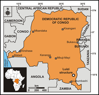
The Luizi structure, centered at 10°10'13.5"S and 28°00'27.0"E, on the Kundelungu Plateau of the Katanga province, lies in an underexplored region of southeastern Democratic Republic of Congo (DRC; Fig. 1), located about 175 km north-northeast of the city of Lubumbashi and approximately 10 km west of the small town of Lukeka.
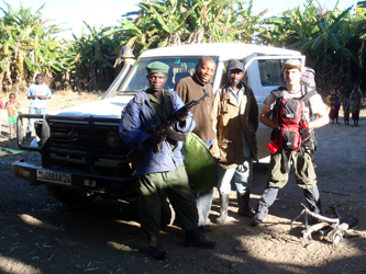
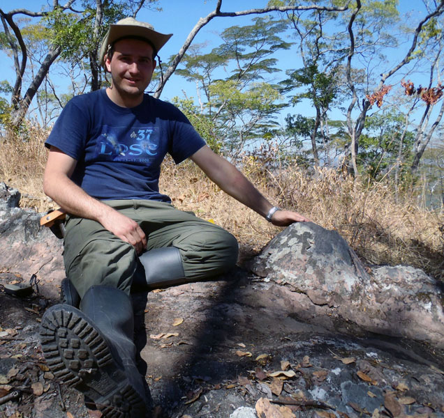
Following preliminary remote sensing studies, the first expedition took place from June 22nd to June 30th 2010, with seven days of fieldwork within the Luizi structure. It was not an easy task to reach the structure, as we had to stop the 4-wheel drive vehicle at the village of Lualala, located about 21 km "as the crow flies" from the center of the crater. We thus had to cover this distance by foot with all our material and food. The driver (Mbuta Mwipatayi) had to stay in the village to look after the car. A military soldier representative of the National Park (Jean Kafwa) came with us for our safety and we also recruited two local porters (Moize Lumbwe and Jérmis Mukalay) to guide us in the tree savannah (Fig. 2).
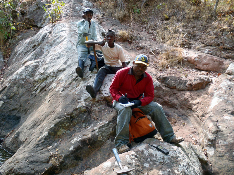
For the next full week, we were in an almost "no man's land," several kilometers from a few huts, the hamlet of Kisibwe. Apparently, according to local people, the last "white guy" to be seen in this region of DRC was a medical doctor about 30 years ago... Field conditions around the site were not optimal, because of the relatively "mountainous" relief, and because almost no trails occur. Most of the time, we had to walk through high grass, which had the advantage of making it impossible to look for snakes!
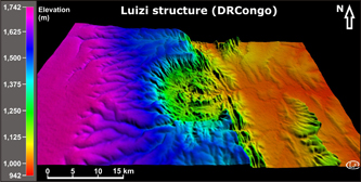
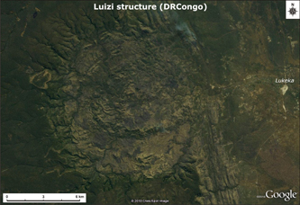
Basic geological field mapping of the area combined with a remote sensing study, using available imagery and topographic data (Figs. 3 & 4), allows us to estimate that the Luizi structure is ~17 kilometers in diameter. It exhibits (from the periphery to the center of the structure): a rim elevated up to ~300350 m above the crater interior, an annular depression, an intermediate ring with a diameter of ~5.2 km, and a ~2 km wide circular central ring around a central depression.
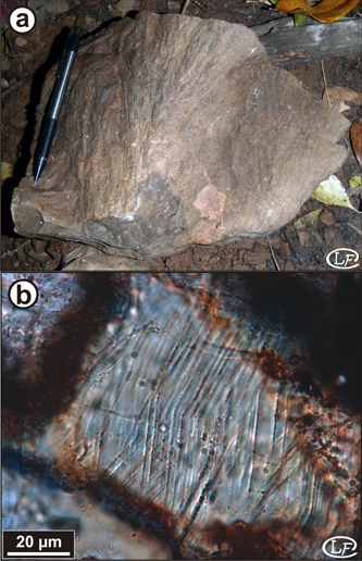
The impact origin of the structure was confirmed in the field with the finding of in-situ well-developed shatter cones in sandstone (Figs. 5 & 6a). The observed shatter cones were up to 40 cm in length, occurring at several locations within the central part of the structure, and up to 1.6 km from the center.
Monomict lithic impact breccia was also observed locally as dikes, up to ~2 m in thickness, and cross-cutting sandstone beds (Fig. 7).
Additionally unambiguous evidence of shock metamorphism were discovered back in the laboratory during petrographic investigations of thin sections prepared from collected samples. Namely, shocked minerals, including hundreds of quartz grains with multiple planar deformation features (PDFs) and shocked feldspars, were observed and characterized (Fig. 6b).
The combination of our field observations and petrographic investigations, together with the remote sensing study, provide definite evidence for an impact origin of the Luizi structure. This structure is a complex meteorite impact crater, the first one to be recognized in Central Africa.
A second expedition to the Luizi impact structure was organized in October 2013, during which we were able to find different types of impactites (including impact breccia dikes and impact melt rocks) and also kimberlites. Preliminary results on these new findings were presented at the Meteoritical Society Meeting in Casablanca (Abstract) in September 2014.
|